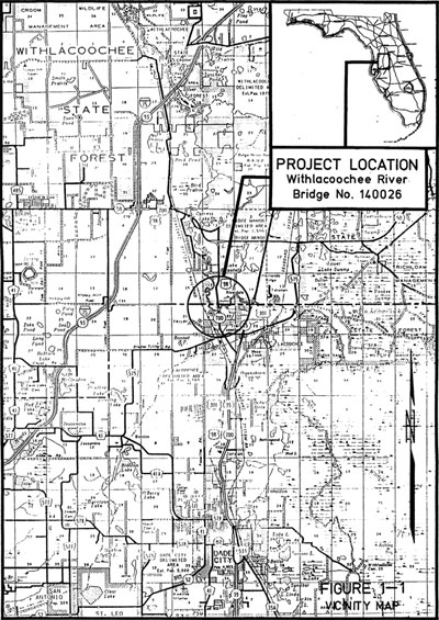
The project entails identifying and evaluating alternatives for the replacement of the SR 700 (US 98) bridge (Bridge No. 140026) over the Withlacoochee River. The existing bridge is located approximately 7 miles north of Dade City in Pasco County at mile post 1.62.
Three viable alternative alignments were identified and analyzed for the replacement of the SR 700 (US 98) bridge over the Withlacoochee River: eastern and western alignments adjacent to the existing bridge and replacement on the existing alignment. Based on public input and the evaluation of impacts to regional and community development, conservation of natural resources, public facilities and services, and total construction costs it is recommended that the bridge be replaced on the existing alignment. Traffic during construction should be maintained by a route detour due to the close proximity of SR 35 (US 301). The additional 1.5 miles travelled by through traffic on the route detour is not significant. A temporary detour bridge at the site is not recommended because of the economic and environmental impacts associated with the construction and demolition of the structure.
Study Purpose and Need
The purpose of this Preliminary Engineering Report was to document the viable alternatives for the replacement of the SR 700 (US 98) bridge over the Withlacoochee River in Pasco County, Florida. The report includes a discussion of the existing conditions, design criteria, description and evaluation of alternatives, input from individuals during the public involvement process, and concluded with a recommended location and length of the replacement bridge.
The existing roadway width of 28 feet is substandard. It needs a minimum width between barrier rails of 44 feet to accommodate two 12-foot travel lanes with 10-foot shoulders. The live load used in the original design (H-15) of the bridge is inadequate. The bridge should be improved so it can support a standard live load based on today’s standards for a typical bridge on a rural principal arterial road. It would be desirable for the bridge to have an estimated remaining live of 40 years.
Proposed Improvements
Based on the evaluation of alternatives and the input from the public meeting, it is recommended that the Existing Alignment in combination with the route detour be retained for further development The Existing Alignment alternative would require the least (if any) amount of right-of-way acquisition, would have the least disruption to the existing environment, and would result in the least construction time and cost. Temporary detour structures are not recommended due to the additional time, expense, and impacts to the environment required for their construction. Phasing construction to allow one lane to remain open is not justified with the easily accessible SR 35 (US 301) to the east of SR 700. Also, only 1.5 miles additional travel for through traffic is required for the proposed detour route and property and business owners on SR 700 do not object to the closure.
A bridge length of 245 feet was recommended in the Location Hydraulics Study. The existing bridge provides approximately 4 feet of clearance above the design flood. Due to the history of flooding along the Withlacoochee River, it is recommended that the proposed structure be no lower than what presently exists.

