click image to view map
U.S. Highway 301 is a north-south federal highway serving the southeastern coast of the United States. Within the State of Florida, U.S. 301 serves as a principal arterial route from north of Jacksonville to Gainesville. From Gainesville, the classification changes to a minor arterial route and serves the state southward to Sarasota by way of Ocala and Tampa. The proposed project involves the portion of the route from Tampa northerly to Zephyrhills and is 22.9 miles in length. Improvement of this portion of the existing facility will connect the existing four-laned section north of Interstate 4 with the existing four-laned section north of the city of Zephyrhills.
Projected traffic volume data indicates the need for multi-laning this facility, as the estimated 1997 average daily traffic projection is 22,360 vehicles. The projected traffic for 1979, two years after the projected completion of construction is 11,220 average daily vehicles.
Right-of-way width along the existing route varies from 200 feet in the southern portion to 100 feet in the northern portion. The proposed improvement will require a minimum right-of-way width of 200 feet in the rural section and 100 feet in the urban section.
U.S. Highway 301 is a State and Federal primary highway. The right-of-way is not controlled access and the type of service to be provided is General Land Service.
The Department’s first annual update of the 11 Plan for Florida’s Principal Highway and Street Systems, 1970-1990, indicates that this portion of U.S. 301 is to be improved to a four-laned facility within the frame work of the 1970-1975 budget.
Along this portion of the existing facility, five stream crossings are involved. They are Flint Creek, Holloman’s Branch, Hillsborough River, Two Hole Branch, and Black Water Creek. The Hillsborough River is the most significant crossing of the above mentioned.
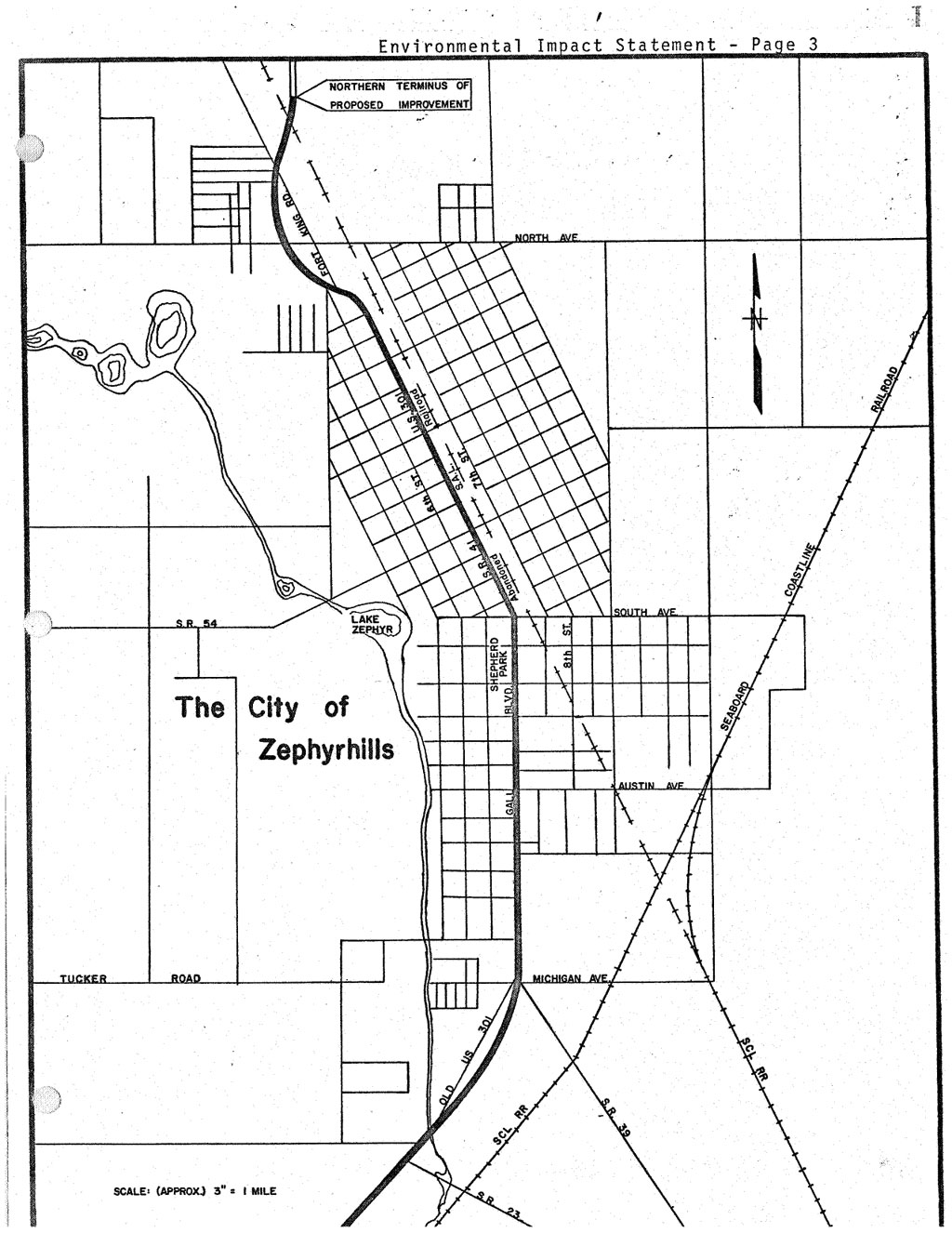
The proposed facility will be rural except the portion through the City of Zephyrhills.
The City of Zephyrhills is an urban community, and serves the surrounding highly developed agricultural areas. The City of Zephyrhills lies on the northerly end of the proposed facility and is a small town of 2 square miles with an estimated population of 5,000. Citrus groves, c~ttle ranches, dairy and poultry farms, as well as light truck farms are to be found in the surrounding areas of Zephyrhills.
Agricultural endeavor is the predominate feature of the area affected by this proposed project, particularly in the northerly and easterly portions. The great majority of the land suitable for agricultural use is being so used. There are some land areas of considerable size that are not suitable for agricultural usage because they are low and subject to flooding for long periods of time. The largest area of this type of land lies on either side of the Hillsborough River and occupies the center portion of the study area. This area contains approximately 30 square miles.
Another area of smaller size (2 square miles) lies in the southeast portion of the study area and is known as the Harney Flats.
Just west of the existing facility in the northern part of Hillsborough County, lies the Hillsborough River State Park. This park contains a land area of 2,810 acres and was visited by 239,119 persons during 1969. Access to that portion of the park developed for public use can be made only by Highway 301. See map on next page. At the present time, a considerable amount of work is planned by the Southwest Florida Water Management District in the central and southern portion of the study area on the west side of the existing alignment. The basic aim of the work planned by this agency is flood relief and water conservation.
Study Purpose and Need
The purpose of this environmental impact statement was to analyze the effects of the proposed project on the natural and social environment of the region through which it passes. The natural environment is defined in this statement as the components of the earth’s life support system: air, water, soil, plants, animal life, etc. The social environment is described, herein, as any human society and its various social and economic components.
Proposed Improvements
U.S. Highway 301 in the State of Florida traverses the state from Sarasota northerly to the Florida – Georgia State line just north of Jacksonville by way of Tampa, Zephyrhills, and Ocala.
The proposed improvement involves four-laning the portion of U.S. Highway 301 between Tampa and Zephyrhills and is 22.9 miles in length. This portion of the U.S. 301 facility functions as a minor arterial route.