click image to view map
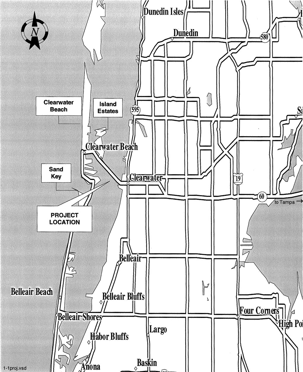
The Memorial Causeway Bridge project involved the replacement of the existing S.R. 60 (Memorial Causeway) bascule (moveable span) bridge, located in Clearwater, Florida, with a four-lane high-level 22.6 m (74 ft) vertical clearance fixed-span bridge. The project area limits extended approximately from just east of Island Way to just west of Fort Harrison Avenue and from just north of S.R. 60 (Cleveland Street) to just south of Chestnut Street. The project was approximately 2.6 km (1.6 mi) in length.
The Memorial Causeway serves as the primary link between mainland Clearwater and Clearwater Beach/Island Estates. Clearwater Beach is a major tourist and recreation destination, and Island Estates is a large residential community which includes commercial uses. The Memorial Causeway is the primary evacuation route for north Sand Key, Clearwater Beach, and Island Estates.
Memorial Causeway is functionally classified as an urban principal arterial. Pierce Boulevard is a four-lane undivided urban arterial which ties directly into the Court/Chestnut Street one-way pair system. Court and Chestnut are two-lanes each west of Oak Avenue and three lanes each east of Oak Avenue, respectively. Cleveland Street is a two-lane divided urban principal arterial, while Drew Street is generally a four-lane undivided facility maintained by the City; within the study area, it is two-lane undivided west of Alternative U.S. 19 with on-street parking allowed.
Study Purpose and Need
The objective of the Memorial Causeway Bridge replacement project was to make improvements to the existing facility which would reduce the number of traffic accidents that occur on the bridge and its approaches, reduce delays to motorists traveling between mainland Clearwater and Clearwater Beach/Island Estates, and improve safety for bicyclists and pedestrians. A new bridge must also be aesthetically compatible with the Downtown Clearwater and Clearwater Beach area. In addition, the study included a traffic analysis to determine roadway improvements which was necessary as a result of the new bridge.
Proposed Improvements
The proposed action is the replacement of the existing S.R. 60 (Memorial Causeway) bascule bridge with a high-level, fixed-span four-lane bridge. The proposed navigational clearance is approximately 22.6 m (74 ft) over the Gulf Intracoastal Waterway in Clearwater Harbor. The proposed minimum horizontal navigational clearance is 30.48 m (100 ft). Both the existing and design year conditions were evaluated, and various alignment alternatives were considered, including the No-Build alternative, in order to determine the most appropriate recommendation for this project. As a result of the public involvement process, the environmental and engineering studies, and interagency coordination, the alternative recommended for Location/Design Concept Approval is Alternative P4A. The recommended alternative alignment is located just south of and parallel to the existing bridge and connects to Pierce Boulevard which extends to the Court Street/ Chestnut Street one-way pair. An additional connection to downtown in the vicinity of Pierce Street is also proposed.