click image to view map
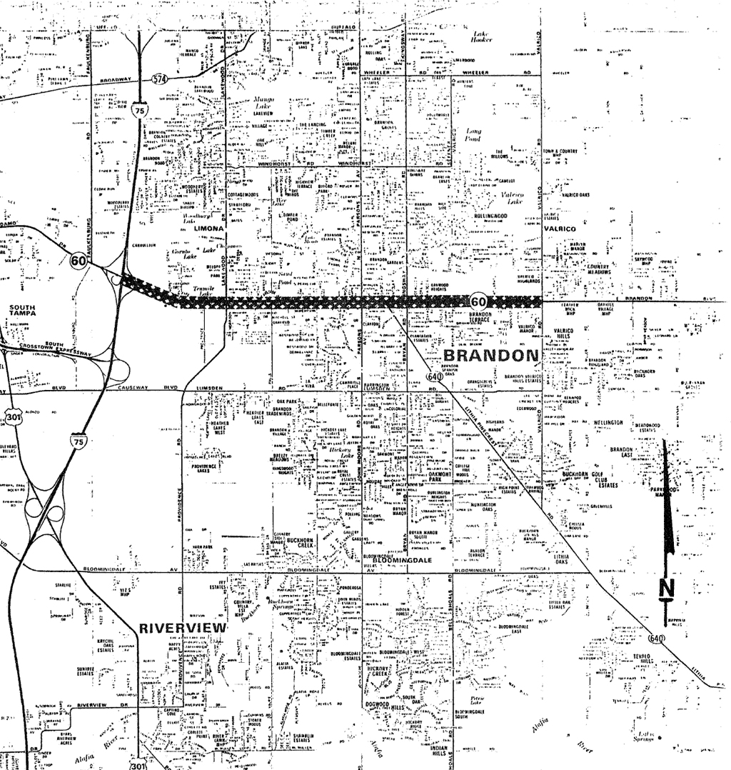
This proposed project involves improvements to State Road 60 in Hillsborough County from State Road 93A (I-75) easterly through Brandon to Valrico Road (Figure 1). SR 60 is classified by the Florida Department of Transportation (FDOT) as an Urban Principal Arterial Highway on the Federal Aid Primary System and extends from Clearwater Beach in Pinellas County to Vera Beach in Indian River County. SR 60 links the Tampa area with SR 93A (I-75), the community of Brandon and rural Hillsborough County.
Study Purpose and Need
The Federal Aid Highway Act of 1962, the Urban Mass Transportation Act of 1964 and the Federal Aid Highway Act of 1973 require a comprehensive, cooperative and continuing planning process in order to qualify for Federal capital participation in highway and mass transit projects. In compliance with these acts, the Tampa Urban Area Metropolitan Planning Organization
(NPO) has completed the Tampa Urban Area Transportation Study (TUATS). The most recent reevaluation by the MPO is the “Tampa Urban Area Transportation Study – Hillsborough County Year 2010 Principal Street and Highway System Plan” adopted in 1986. The improvements proposed in this study are in compliance with this plan.
Proposed Improvements
The existing facility is predominantly a four-lane rural design incorporating a short, narrow six-lane urban section from Knights Avenue to Kingsway Road. From SR 93A to the vicinity of Knights Ave. and from Oakwood Ave. to Valrico Rd., the existing roadway consists of 12-foot lanes, two in each direction, separated by a 40-foot grass median within 182 feet of existing right-of-way. From Kingsway Rd.to Oakwood Ave., the same typical section exists separated by a 20-foot grass median within 160 feet of existing right-of-way. All three segments have a 38-foot shallow swale ditch contiguous to the north side of the roadway and a 56-foot shallow swale ditch contiguous to the south side.
From Knights Ave. to Kingsway Rd., the right-of-way varies from 91 to 120 feet and the existing roadway consists of six lanes approximately 11-feet wide separated by a raised median that varies from 14 to 18 feet. Sidewalk, curbs and gutters are provided along each side of the roadway.
The proposed facility will include an upgrading of approximately 4.5 miles of SR 60 to a six-lane divided urban design with continuous right-turn lanes (See Engineering Alternatives Report). Wide curb lanes are proposed to accommodate bicycle traffic. Utilization and location of median openings and a possible “progressive signal system” have been identified to maximize roadway use to accommodate local and through traffic. The distance between the signalized intersections will be limited to approximately 0.25 miles (1320 ft.). This is done to achieve optimum flow by maximizing the effectiveness of the signal progression system. The incorporation of an urban design allows for minimal right-of-way acquisition.
Anticipated construction cost for the 4.5 mile improvement is approximately $20.5 million.