click image to view map
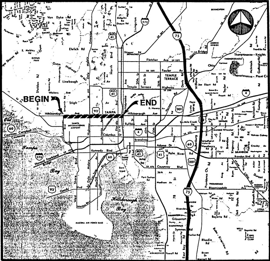
This report presents the various build and no-build alternatives considered for Hillsborough Avenue (S.R. 580/600) from Eisenhower Boulevard (S.R. 589) to the vicinity of Nebraska Avenue (S.R.45/U.S. 41), in Tampa, Florida. The length of the project is approximately six miles. The methodology used in analyzing the proposed alternatives is discussed along with the justification for the elimination of non-viable alternatives from further study. The purpose of this report is to serve as a supplement to the environmental reports, to fully document the major alternatives considered, but not addressed at the Public Hearing for the project.
This Report incorporates all revisions made in the conceptual design subsequent to the public hearing and through April, 1989, including incorporation of Addendums Number One and Two, issued in July, 1988 and November, 1988 respectively. Previous drafts of this Report were submitted in May and November of 1986 and April, 1988. This Report also incorporates changes made as part of the preliminary design phases and coordination with community groups through May, 1989.
Study Purpose and Need
Hillsborough Avenue (S.R. 580/600) is classified as an urban principal arterial within the study area. On the western end, one branch ties into S.R. 584 where it connects upper Pinellas County (Palm Harbor, Oldsmar) to Hillsborough County. It serves as a continuous east-west route through Hillsborough County, where it provides access to other north-south State Roads, including Eisenhower Boulevard, Dale Mabry Highway, Florida Avenue, I-275, Nebraska Avenue, 22nd Street, 56th Street, U.S. 301 and I-75. It also interchanges with I-4 near the U.S. 301 intersection. East of I-75, it continues south of and parallel to I-4 to Plant City and beyond.
Hillsborough Avenue is extensively used by emergency vehicles (Sheriff Dept., Tampa Police Dept., Fire Rescue and EMS, Fire Department); however, the existing congestion and narrow lanes (east of Habana Avenue) hamper emergency response times and thereby reduces the usefulness of this highway as a route for emergency vehicles. Hillsborough Avenue also serves as an evacuation route serving portions of Pinellas and Hillsborough Counties.
Proposed Improvements
Design Speed and Horizontal and Vertical Alignment
The recommended design speed is 45 mph for all segments of Hillsborough Avenue.
The proposed horizontal alignment is illustrated on the conceptual design drawings and it generally follows existing alignment, which is tangent for the most part. In the vicinity of the proposed bridge over the Hillsborough River, a one degree+ curve would be required on the eastbound approach to the bridge in order to construct a replacement bridge north of the existing one. The existing bridge would remain in service during construction of the new bridge.
Proposed vertical alignment would generally follow the existing vertical alignment including the replacement bridge and its approaches.
Major Drainage Features
Drainage outfall locations are proposed at existing outfall locations. On the west end, between Eisenhower Blvd. and Dale Mabry, outfall locations consist of lateral ditches which run northerly to connect to the Henry Avenue canal (which ultimately drains into Tampa Bay). Detention ponds are proposed as shown on the concept drawings for storm water flow attenuation and treatment. For the eastern half of the project, most of the drainage areas would outfall to the Hillsborough River through underground pipe systems. Potential detention areas are identified on the conceptual design drawings.
Major Intersection Improvements
As part of the proposed six-laning of Hillsborough Avenue, several intersections are proposed to be widened to include dual left-turn lanes and exclusive right-turn lanes, where warranted by projected Year 2010 design hour volumes. As shown on the conceptual design plans, these include Hillsborough at: Benjamin Road, Himes Avenue, Habana Avenue, Armenia Avenue, Wishart Blvd., Florida Avenue, and Nebraska Avenue.
Pedestrian and Bicycle Accommodations
For the “modified rural” typical sections, minimum 4′ paved shoulders are proposed to facilitate bicycle travel: for the urban sections, 14′ curb lanes are proposed which is consistent with FDOT’s current design policies.
It is recommenc;led that the mid-block pedestrian crossing signal located just west of Mendenhall Drive be retained following the widening of Hillsborough Avenue as there are no plans to change school boundaries, etc.
Access Control
As previously mentioned in Chapter 6, medial access control measures are proposed consisting of special channelizing islands to be used in conjunction with standard raised islands. These channelizing islands are designed to prevent left-turn egress from driveways and minor (local) street approaches. Motorists will still .be able to make left-turns off of Hillsborough Avenue at median openings, which will average 500′-600’+ typical spacing. Median widths will typically range from 22′ to 28′, the latter width proposed for areas with greater frequency of dual left turn lanes on Hillsborough Avenue.
Utilities and Railroads
Routine utility adjustments are expected as part of the proposed reconstruction of Hillsborough Avenue. Existing utilities within the right-of-way include water mains, sanitary sewer, gas, telephone and electric.
With respect to utility crossings at the Hillsborough River, during the bridge design phase, it will be the responsibility of individual relocation of their respective utility lines. During the planning of the construct ion and demolition, it will be determined whether the existing bridge can be removed without disrupting the continuity of utility service. The individual utilities will be required to review the methods they would use to relocate their service before dredge and fi 11 quanti ties can be determined. In addition, the individual utilities must obtain their own dredge and fill permits and negotiate sovereign land use with the respective agencies since individual or unique permit conditions may be imposed by the permitting agencies.
With respect to the probable environmental impact, generally submarine cable crossings can be accomplished with minimal environmental impacts. This generality is of course depend~nt upon the site specific conditions and the methods used to install the cable. For example, FAC 17-4.04(9) (p) provides a FDER permit exemption for “the installation of subaqueous transmission and distribution lines laid on, or embedded in the bottoms of waters of the state, except in Class I-A and Class II waters and aquatic preserves provided that no dredging or filling is necessary”.
Maintenance of Traffic Concepts
During the construction phase, the contractor will be required to maintain four lanes of traffic, at least during the peak travel hours. In the vicinity of the bridge, construction on the replacement bridge will take place while traffic is maintained on the existing structure. The maintenance of traffic plan will be dependent on construction sequencing including the need to maintain drainage during the construction process.