Click image to view map
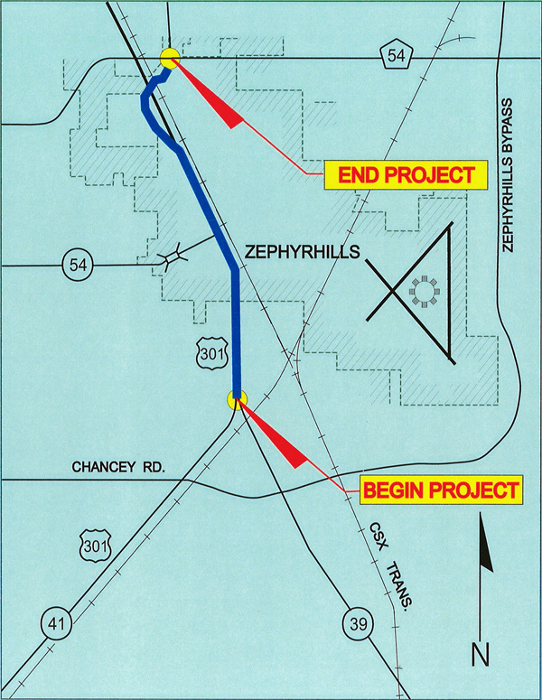
The Florida Department of Transportation (FDOT) conducted a Project Development and Environment (PD&E) Study for the improvement of U.S. 301 (S.R. 41) between S.R. 39 and C.R. 54, in Pasco County, Florida a distance of approximately 2.6 miles. The project map illustrates the location and limits of the project and its relationship to the regional highway system.
The objective of the PD&E Study was to provide documented information and analyses which would help the FDOT and the Federal Highway Administration (FHWA) reach a decision on the type, design and location of the necessary improvements along U.S. 301 to accommodate the future traffic demand in a safe and efficient manner. The PD&E Study satisfied the requirements of the National Environmental Policy Act (NEPA) and other federal and state requirements in order to qualify the future design, Right of Way acquisition, and construction phases of the project for federal funding and implementation.
This report documents the information necessary to confirm the need for this project and develops and evaluates various improvement alternatives as they relate to the transportation facility. Information relating to the engineering and environmental characteristics essential for alignment criteria were set and alternatives were developed. Comparison of alternatives was based on a variety of parameters using a matrix format. This analytical process identifies the alternative that would have the least impact while providing the necessary improvements. The design year of the analysis is Year 2025. The No-Build Alternative is considered a viable alternative throughout this PD&E Study.
Study Purpose and Need
This report identifies the current and future deficiencies that should be expected along U.S. 301 if the existing geometric characteristics are maintained, and presents feasible improvement alternatives that will meet future traffic demands. This report documents the development of all improvement alternatives after consideration of socioeconomic, cultural and environmental effects. This Final draft presents the Recommended Alternative and the reasons for its selection.
Project Description
The U.S. 301 (S.R. 41) corridor is a north/south principal arterial facility that traverses through Tampa, Zephyrhills, Dade City, and continues north. The location and limits of the project are shown in Figure 2-1. Appendix A of this report includes copies of roadway maps and the Department’s straight line diagrams illustrating all intersecting streets and roadways. The project is located partly in unincorporated Pasco County, from S.R. 39 to C Avenue. The section from C Avenue north to C.R. 54 is in the City of Zephyrhills.
The existing roadway is a two lane rural road with four foot paved shoulders. A one-way pair was created in 1996 by the City of Zephyrhills using 6th and 7th Streets as an alternate route to U.S. 301. The City’s one-way pair system begins at A Avenue for northbound traffic on 7th Street and ends at C Avenue for southbound traffic on 6th Street. This Study considered the extension of the one-way streets, continuing 6th and/or 7th Street one-way to S.R. 39.