click image to view map
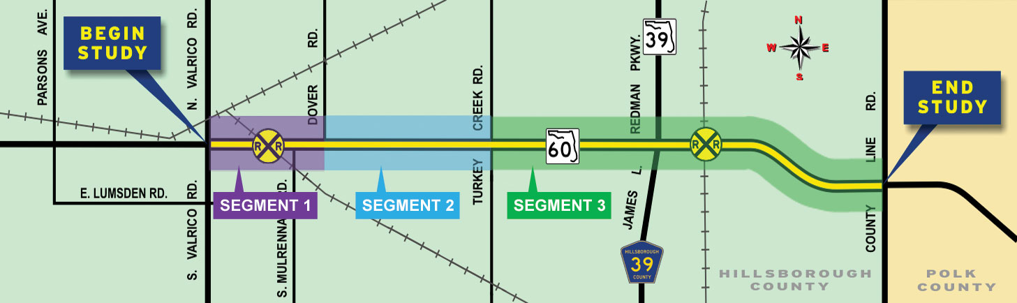
The Florida Department of Transportation (FDOT) conducted a Project Development & Environment (PD&E) study to consider widening a portion of State Road 60 (SR 60). Located in Hillsborough County, the limits of this study are from Valrico Road at the west end extending eastward to the Polk County Line, a distance of approximately 12.3 miles.
Study Purpose and Need
The Hillsborough County Metropolitan Planning Organization (MPO) identified and documented the need to widen and improve SR 60 in their 2035 Long Range Transportation Plan. These improvements will accommodate the projected future traffic volumes, enhance motorist safety, and reduce emergency response times.
Proposed Improvements
Within the project limits, the existing system is a major roadway, and the proposed improvement will expand the current 4-lane facility to 6-lanes. SR 60 is a major east-west roadway and is part of the Florida Intrastate Highway System (FIHS). SR 60 provides connectivity with many of Florida’s major highways and is a vital link in the regional transportation network connecting the Tampa Bay region to the remainder of the state. SR 60 is a part of the Strategic Intermodal System (SIS), which provides efficient multi-modal transportation facilities and provides connections to airports, seaports, bus and rail terminals. SR 60 is also designated as an emergency evacuation route.